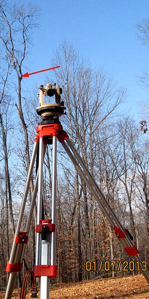
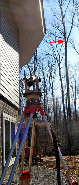
There are hundreds of trees around us, but how tall are the two I chose for antenna supports? I used a 300' tape measure to establish a baseline, and a theodolite to "shoot" some angles, then calculated the height of the support points (red arrows). The left photo shows the north support point, at 65' high, and the center photo shows the south point, at 58'.
|
|
|
|
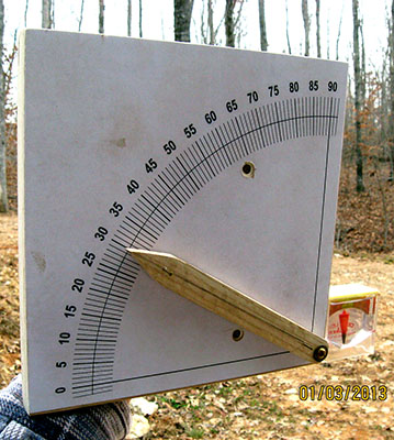
Don't have a theodolite? Make your own angle finder from wood, an angle scale, and a level. I made the one in the right photo for use where it is inconvenient to set up the theodolite. The two countersunk screws hold a handle on the back that was removed from a floor tile adhesive trowel. This handle makes it much easier to hold the angle finder. The small level glued to the right edge helps ensure the angle finder is level while sighting along the wooden pointer.
I drew my own angle scale in Adobe Illustrator, but you can do the same thing in (free) LibreOffice's drawing module. A plastic classroom protractor would work as well as a printed scale.
This diagram shows how I calculated the height of each antenna support point from one measured distance (D) and two measured elevation angles (α1, α2).
Note: The diagram shows the north support height as 70'. Initially I'd planned to use the crotch above the red arrow in the left photo above, but later I chose the lower crotch because it looks sturdier. This crotch is about 65' high, and angle α1 is a fraction of a degree less.
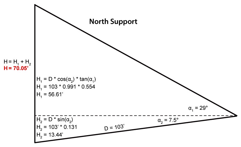
D is the distance measured along the ground from the tree base to directly below the theodolite. α1 is the elevated angle from the level theodolite to the support point. α2 is the depressed angle to the tree base, due to the height of the theodolite. In this case, the theodolite was nearly 14' above the tree base – attached to a 5' tripod standing on ground 9' higher than the tree base.
I measured 176' between the trees – more than enough for the 133' antenna. The wire will be oriented with its broadside radiation bearing 72° (ENE) and 252° (WSW).
Updated April 18, 2025